
Related Images


Download:
| Tiny | 173x128 | View | Download |
| Small | 347x256 | View | Download |
| Medium | 695x512 | View | Download |
| Large | 1390x1024 | View | Download |
| Original | 3000x2210 | View | Download |
This image was acquired from
wikimedia. It was marked as Public Domain or CC0 and is free to use. To verify, go to the source and check the information there.
Looking for more info about this image?
Try a Google Reverse Image Search for it.
Try a Google Reverse Image Search for it.
Keywords from Image Description:
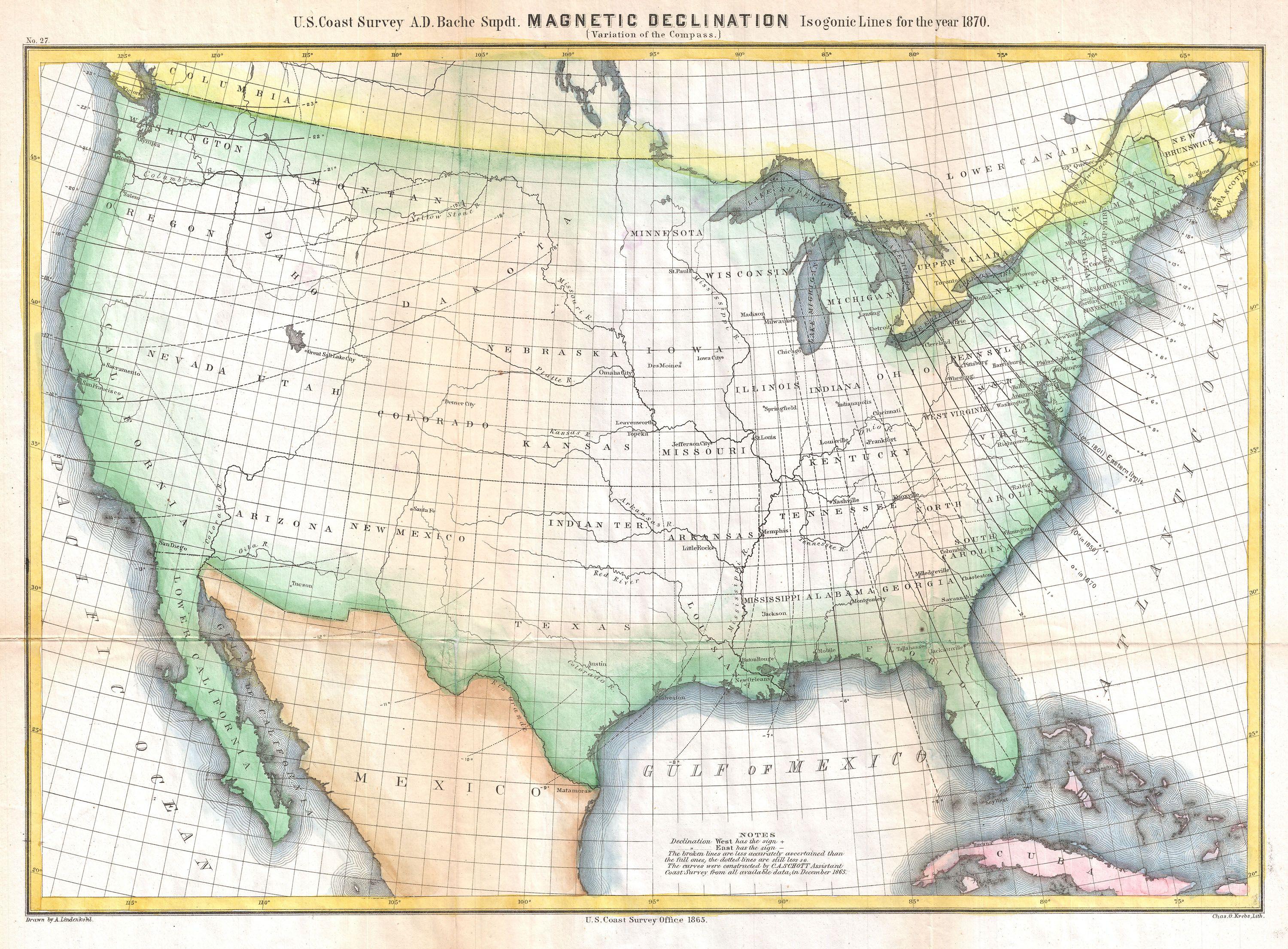
U.S. Coast Survey Map Showing Magnetic Declination in the United States Geographicus MagneticDeclinationuscs. highly unusual Coast Survey chart of the United States showing magnetic declination in the year Magnetic Declination or as it is more commonly known Magnetic Variance refers to the difference between true north and compass