
Related Images


Download:
| Tiny | 151x128 | View | Download |
| Small | 302x256 | View | Download |
| Medium | 604x512 | View | Download |
| Large | 1208x1024 | View | Download |
| Original | 3500x2966 | View | Download |
This image was acquired from
wikimedia. It was marked as Public Domain or CC0 and is free to use. To verify, go to the source and check the information there.
Looking for more info about this image?
Try a Google Reverse Image Search for it.
Try a Google Reverse Image Search for it.
Keywords from Image Description:
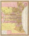
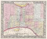
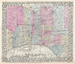
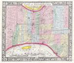
Mitchell's Street Map of Philadelphia Geographicus Philim. This hand colored item is copper plate lithograph plan or map of Philadelphia dating to Produced by the important American cartographer Mitchell Jr Depicts the whole of Philadelphia divided into districts or wards The remarkable detail on this map extends down to the