Related Images
Download:
| Tiny | 106x128 | View | Download |
| Small | 212x256 | View | Download |
| Medium | 424x512 | View | Download |
| Large | 848x1024 | View | Download |
| Original | 3313x4000 | View | Download |
This image was acquired from
wikimedia. It was marked as Public Domain or CC0 and is free to use. To verify, go to the source and check the information there.
Looking for more info about this image?
Try a Google Reverse Image Search for it.
Try a Google Reverse Image Search for it.
Keywords from Image Description:
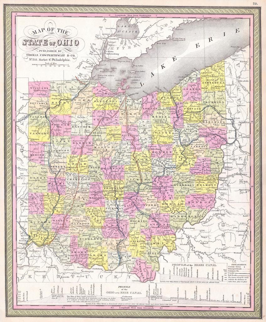
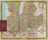
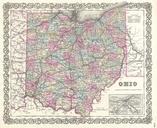
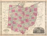
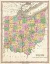
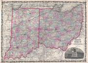
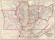
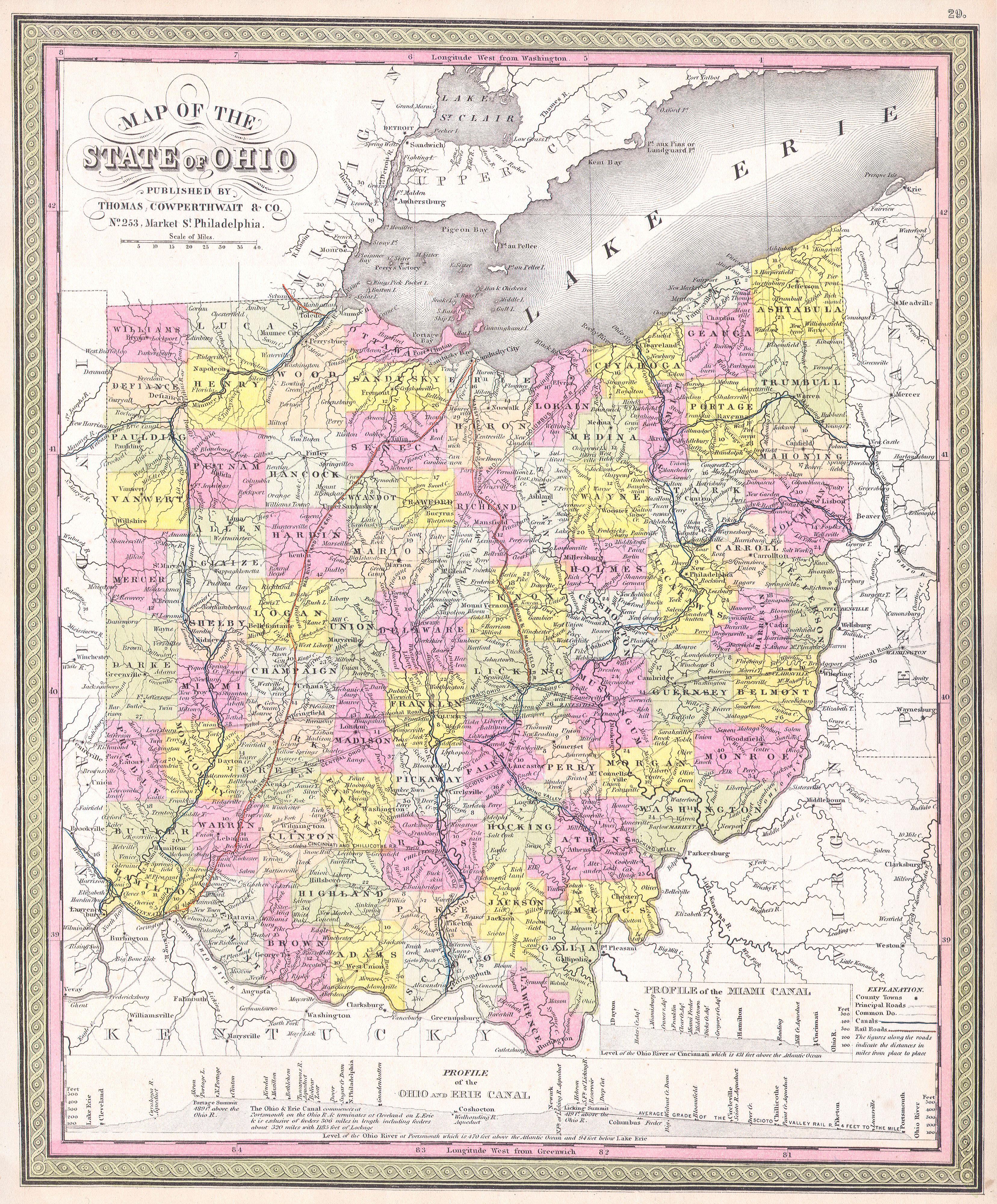
Mitchell Map of Ohio Geographicus Ohiom. This is beautiful hand colored map is lithographic engraving of the state of Ohio dating to Map divides the state into counties with notations on both political and geographical features Produced by the legendary American map publisher Mitchell Sr in conjunction with Thomas Cowperthwait