
Related Images

Download:
| Tiny | 159x128 | View | Download |
| Small | 319x256 | View | Download |
| Medium | 639x512 | View | Download |
| Large | 1279x1024 | View | Download |
| Original | 2500x2001 | View | Download |
This image was acquired from
wikimedia. It was marked as Public Domain or CC0 and is free to use. To verify, go to the source and check the information there.
Looking for more info about this image?
Try a Google Reverse Image Search for it.
Try a Google Reverse Image Search for it.
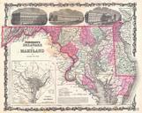
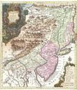
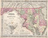
Keywords from Image Description:
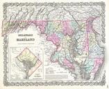
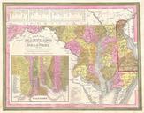
Johnson's Map of Maryland and Delaware Geographicus DEMDj. This is magnificent hand colored map of the states of Maryland and Delaware by the important American map Publisher Johnson Depicts the two states in considerable detail Includes large inset map of the District of Columbia or Washington Made during the Civil war this