
Related Images


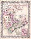
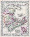
Download:
| Tiny | 188x128 | View | Download |
| Small | 377x256 | View | Download |
| Medium | 754x512 | View | Download |
| Large | 1509x1024 | View | Download |
| Original | 5000x3392 | View | Download |
This image was acquired from
wikimedia. It was marked as Public Domain or CC0 and is free to use. To verify, go to the source and check the information there.
Looking for more info about this image?
Try a Google Reverse Image Search for it.
Try a Google Reverse Image Search for it.
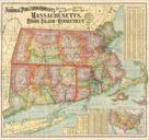
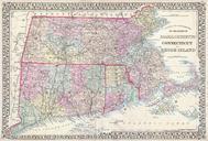
Keywords from Image Description:
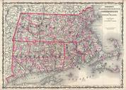
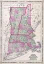
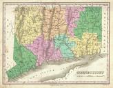
Mitchell Map of Massachusetts Connecticut and Rhode Island Geographicus MACTRImitchell. beautiful example of Mitchell Jr map of Massachusetts Connecticut and Rhode Island Shows cities towns railroads and roadways with color coding according to district Also includes both Martha Vineyard and Nantucket Features the vine motif border