Related Images


Download:
| Tiny | 99x128 | View | Download |
| Small | 199x256 | View | Download |
| Medium | 398x512 | View | Download |
| Large | 796x1024 | View | Download |
| Original | 2724x3500 | View | Download |
This image was acquired from
wikimedia. It was marked as Public Domain or CC0 and is free to use. To verify, go to the source and check the information there.
Looking for more info about this image?
Try a Google Reverse Image Search for it.
Try a Google Reverse Image Search for it.
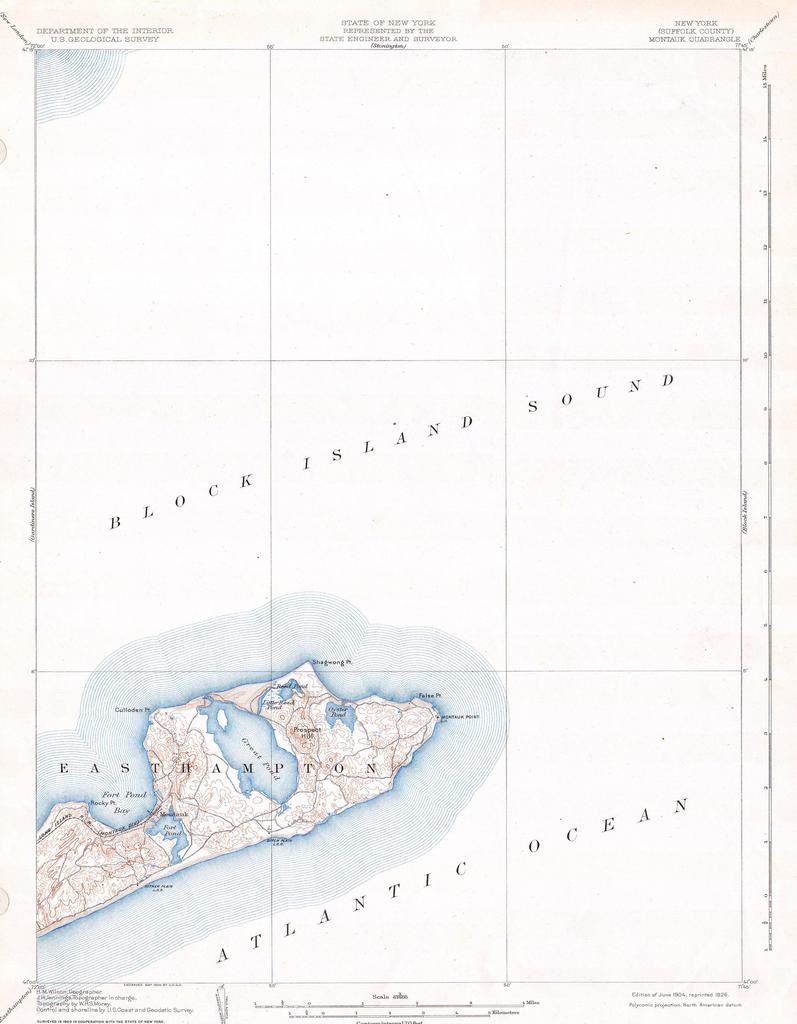
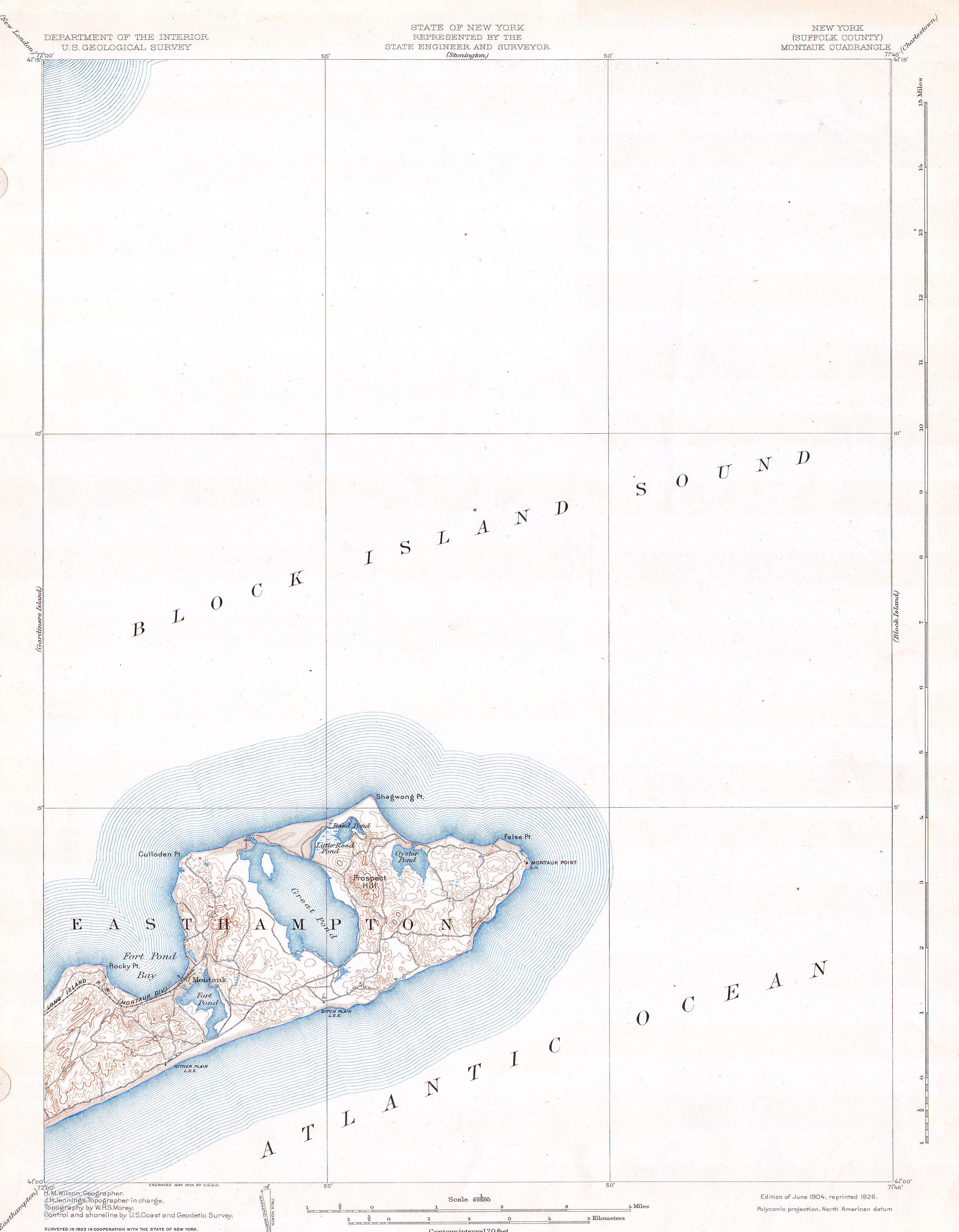
Keywords from Image Description:
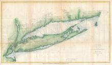
U.S.G.S. Map of Long Island New York Montauk Easthampton Geographicus Montaukuscs. This beautiful and fascinating topographical chart depicts the Long Island New York region of Montauk and Easthampton Shows the beach communities of Montauk surrounding Fort Pond Bay Rocky Point Culloden Pint Prospect Hill Oyster Pond Shagwong