Related Images


Download:
| Tiny | 166x128 | View | Download |
| Small | 333x256 | View | Download |
| Medium | 667x512 | View | Download |
| Large | 1334x1024 | View | Download |
| Original | 9371x7190 | View | Download |
This image was acquired from
wikimedia. It was marked as Public Domain or CC0 and is free to use. To verify, go to the source and check the information there.
Looking for more info about this image?
Try a Google Reverse Image Search for it.
Try a Google Reverse Image Search for it.
Keywords from Image Description:
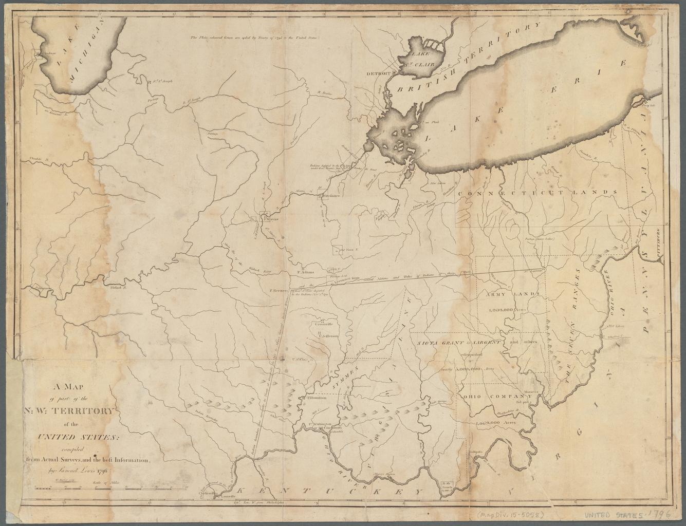
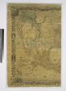
A map of part of the N. W. Territory of the United States NYPL b. en Relief shown pictorially Identifies individual land grants in area that would become Ohio Prime meridian Philadelphia Longitude coordinates expressed here as measured from Greenwich Note printed near top center of map indicates map meant to be colored The plots