
Related Images


Download:
| Tiny | 178x128 | View | Download |
| Small | 356x256 | View | Download |
| Medium | 712x512 | View | Download |
| Original | 1244x894 | View | Download |
This image was acquired from
wikimedia. It was marked as Public Domain or CC0 and is free to use. To verify, go to the source and check the information there.
Looking for more info about this image?
Try a Google Reverse Image Search for it.
Try a Google Reverse Image Search for it.
Keywords from Image Description:
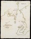
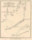
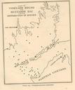
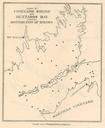
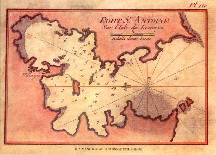
Moudros Bay chart. en Old chart of Moudros Bay Limnos Island Greece In the past it was also called Port St Antonio See New piloting directions for the Mediterranean sea the Adriatic or Gulf of Venice the Black sea Grecian archipelago and the seas of Marmara and Azof by John William Norie Recueil des principaux plans des ports et