Related Images


Download:
| Tiny | 101x128 | View | Download |
| Small | 203x256 | View | Download |
| Medium | 406x512 | View | Download |
| Large | 813x1024 | View | Download |
| Original | 3176x4000 | View | Download |
This image was acquired from
wikimedia. It was marked as Public Domain or CC0 and is free to use. To verify, go to the source and check the information there.
Looking for more info about this image?
Try a Google Reverse Image Search for it.
Try a Google Reverse Image Search for it.
Keywords from Image Description:
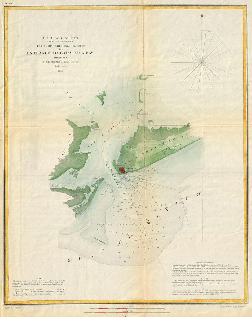
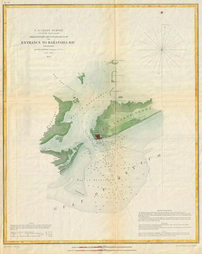
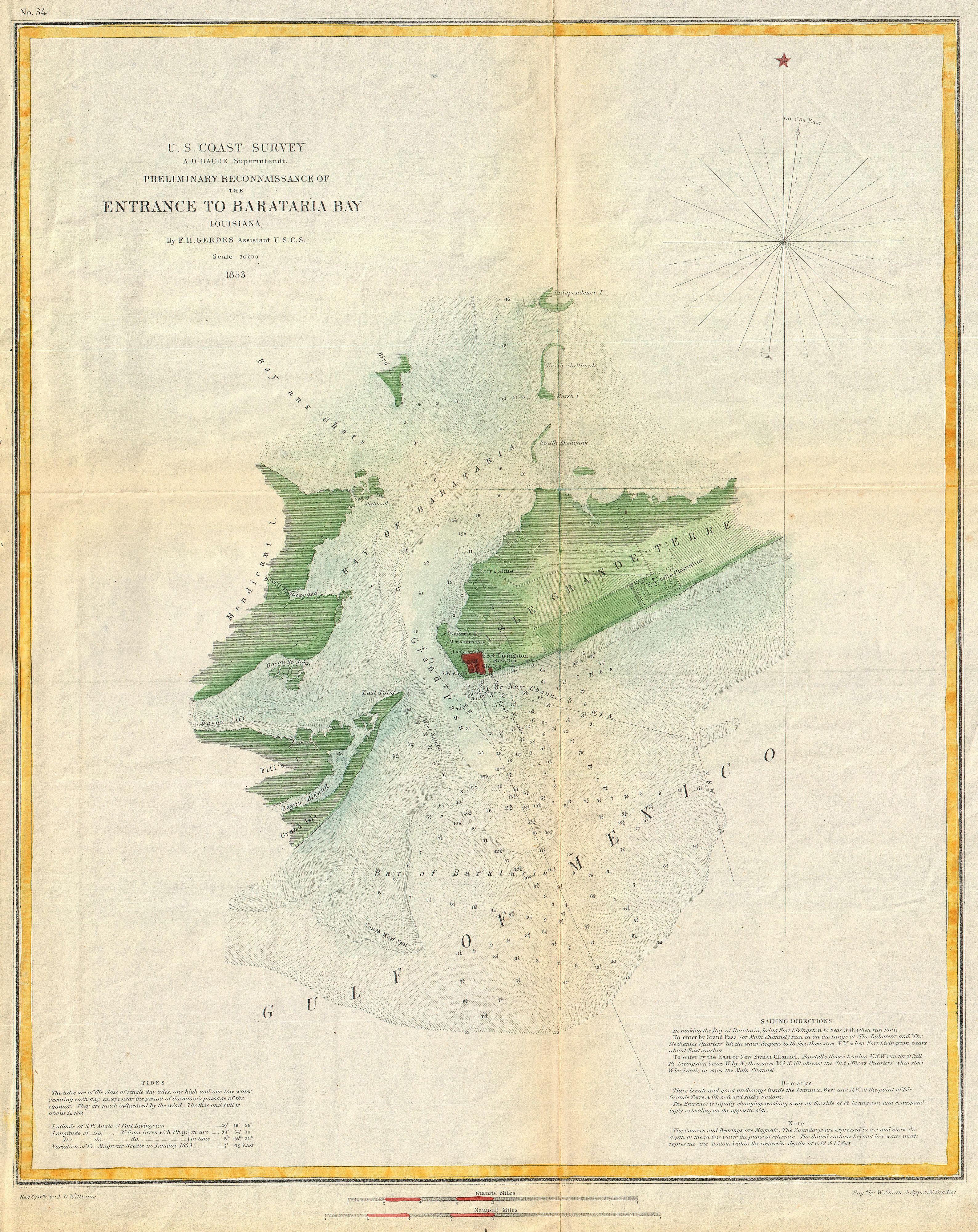
U.S. Coast Survey Map or Chart of Bartaria Bay Louisiana Geographicus BaratariaBayuscs. This is an attractive Coast Survey chart or nautical map or Barataria Bay Louisiana Covers from Grand Isle and Bayou Rigaud eastward Past Fort Livingston and Forstall Plantation Extends northward past Mendicant Island to Independence Island