Related Images


This image was acquired from
wikimedia. It was marked as Public Domain or CC0 and is free to use. To verify, go to the source and check the information there.
Looking for more info about this image?
Try a Google Reverse Image Search for it.
Try a Google Reverse Image Search for it.
Keywords from Image Description:
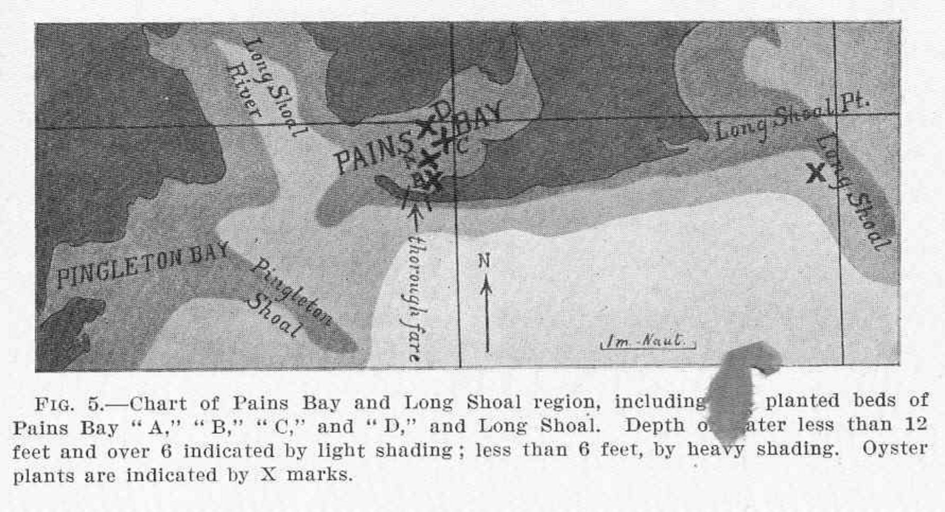
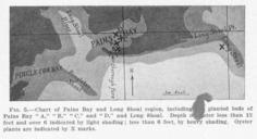
FMIB Chart of Pains Bay and Long Shoal region including the planted beds of Pains Bay and and Long Shoal Depth of.jpeg check categories August Chart of Pains Bay and Long Shoal region including the planted beds of Pains Bay and and Long Shoal Depth of water less than feet and over indicated by light shading less than feet