
Related Images
Download:
| Tiny | 124x128 | View | Download |
| Small | 248x256 | View | Download |
| Medium | 496x512 | View | Download |
| Large | 993x1024 | View | Download |
| Original | 2128x2193 | View | Download |
This image was acquired from
wikimedia. It was marked as Public Domain or CC0 and is free to use. To verify, go to the source and check the information there.
Looking for more info about this image?
Try a Google Reverse Image Search for it.
Try a Google Reverse Image Search for it.
Keywords from Image Description:
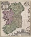
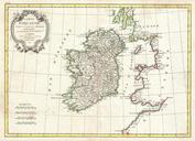
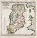
Vaugondy Map of Ireland Geographicus Irelandvaugondy. rare and beautiful Map of Ireland by the French cartographer Robert de Vaugondy Depicts the entire island with county and regional subdivisions defined Beautiful original hand color This map was originally published in the edition of Vaugondy Atlas Portratif Universel et