Related Images

Download:
| Tiny | 146x128 | View | Download |
| Small | 292x256 | View | Download |
| Medium | 584x512 | View | Download |
| Large | 1169x1024 | View | Download |
| Original | 5000x4379 | View | Download |
This image was acquired from
wikimedia. It was marked as Public Domain or CC0 and is free to use. To verify, go to the source and check the information there.
Looking for more info about this image?
Try a Google Reverse Image Search for it.
Try a Google Reverse Image Search for it.
Keywords from Image Description:
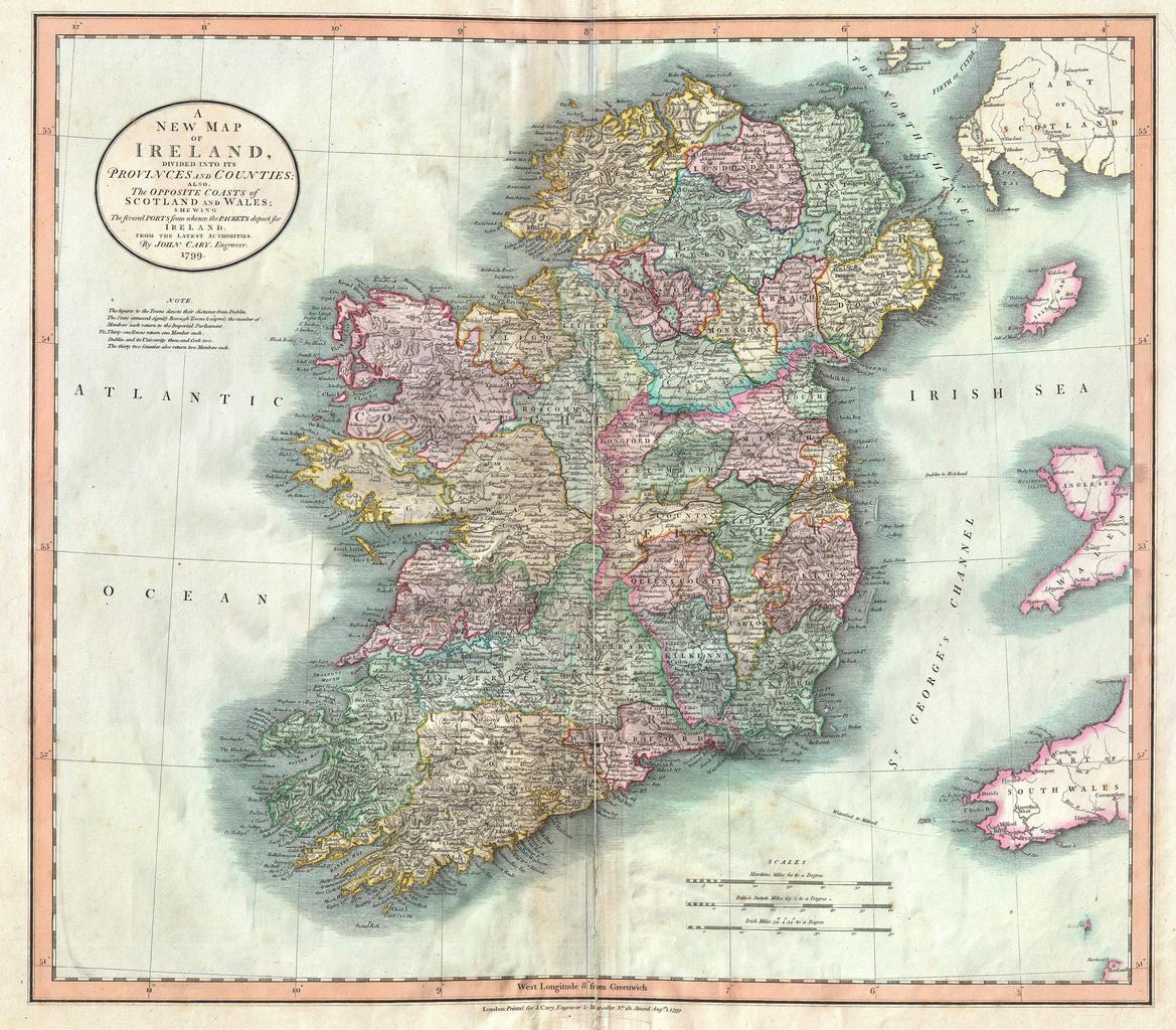
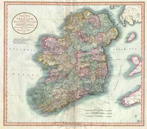
Cary Map of Ireland Geographicus Irelandcary. John Cary wonderful Map of the Ireland Depicts the Emerald Isle in considerable detail with color coding at the county and province level Also includes parts of nearby Scotland and Wales Figures above many of the town names denote distance along the roads from Dublin Prepared in by