
Related Images


Download:
| Tiny | 177x128 | View | Download |
| Small | 355x256 | View | Download |
| Medium | 711x512 | View | Download |
| Large | 1422x1024 | View | Download |
| Original | 5000x3600 | View | Download |
This image was acquired from
wikimedia. It was marked as Public Domain or CC0 and is free to use. To verify, go to the source and check the information there.
Looking for more info about this image?
Try a Google Reverse Image Search for it.
Try a Google Reverse Image Search for it.
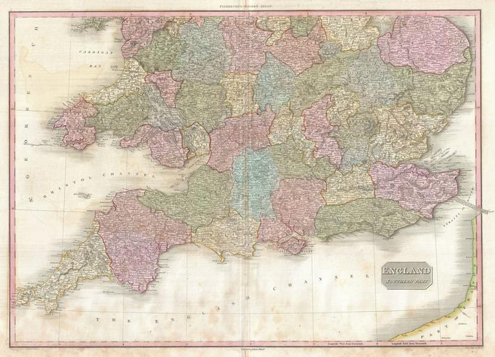
Keywords from Image Description:
Pinkerton Map of Southern England includes London Geographicus EnglandSouthpinkerton. Pinkerton's extraordinary map of the southern part of England Covers the southern half of England from Norfolk and Staffordshire in the north to Cornwall in the south Includes part of France across the English Channel Covers the entire region