Related Images


Download:
| Tiny | 103x128 | View | Download |
| Small | 206x256 | View | Download |
| Medium | 412x512 | View | Download |
| Large | 825x1024 | View | Download |
| Original | 3000x3723 | View | Download |
This image was acquired from
wikimedia. It was marked as Public Domain or CC0 and is free to use. To verify, go to the source and check the information there.
Looking for more info about this image?
Try a Google Reverse Image Search for it.
Try a Google Reverse Image Search for it.
Keywords from Image Description:
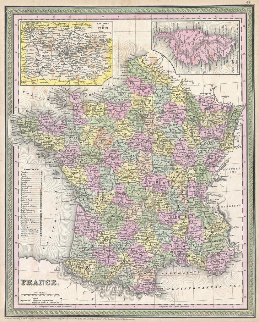
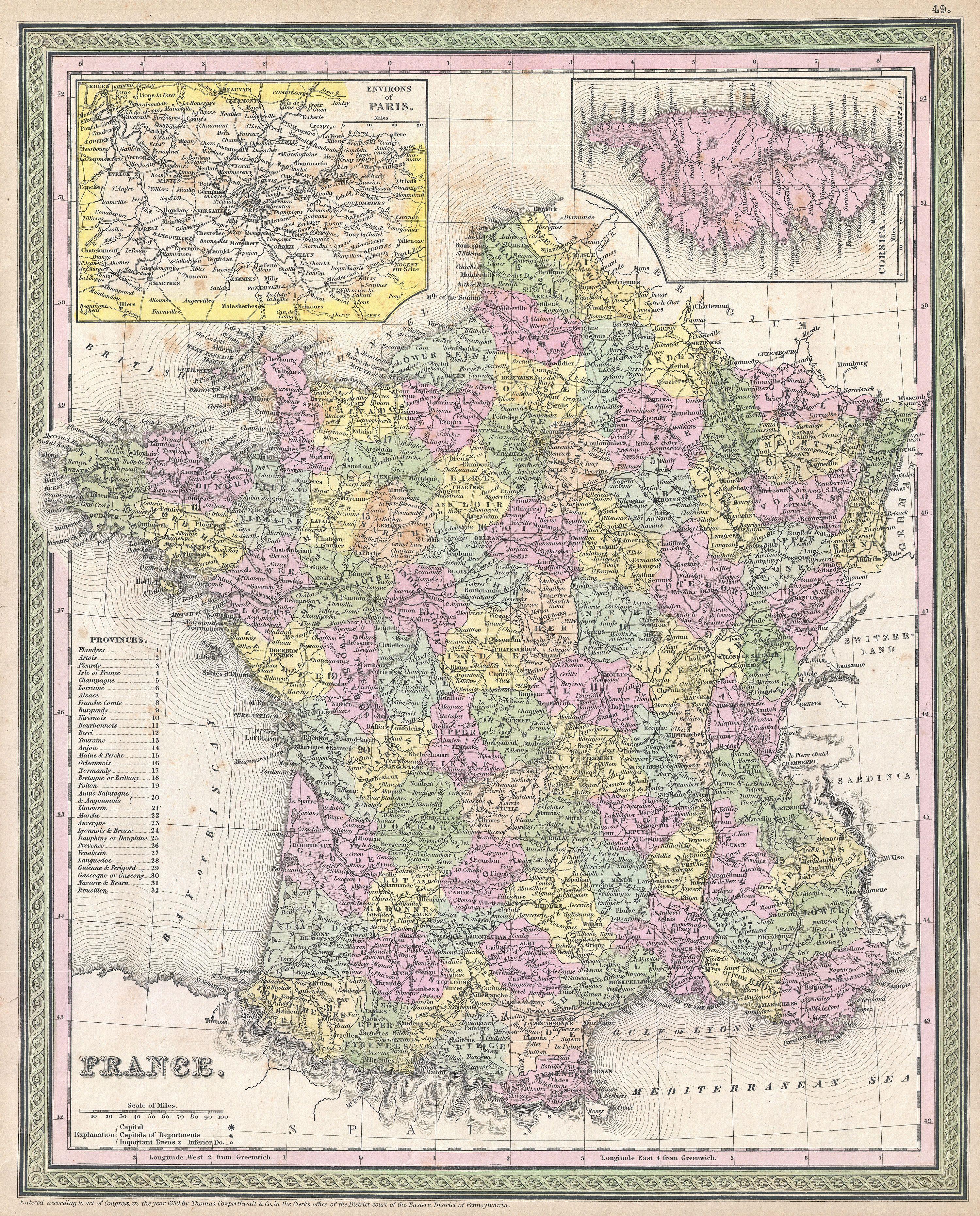
Mitchell Map of France Geographicus Francemitchell. An attractive example of Mitchell Sr map of Europe Depicts the entire country color coded according to individual departments Inset maps in the upper left and right quadrants detail the Environs of Paris and Corsica Surrounded by the green border common to Mitchell maps from