Related Images


Download:
| Tiny | 138x128 | View | Download |
| Small | 276x256 | View | Download |
| Medium | 552x512 | View | Download |
| Large | 1104x1024 | View | Download |
| Original | 3500x3246 | View | Download |
This image was acquired from
wikimedia. It was marked as Public Domain or CC0 and is free to use. To verify, go to the source and check the information there.
Looking for more info about this image?
Try a Google Reverse Image Search for it.
Try a Google Reverse Image Search for it.
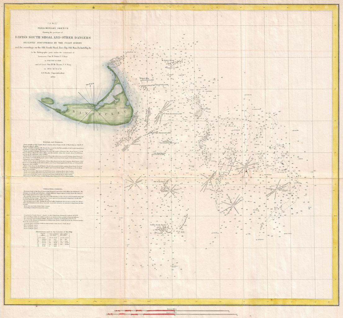
Keywords from Image Description:
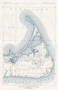
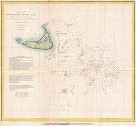
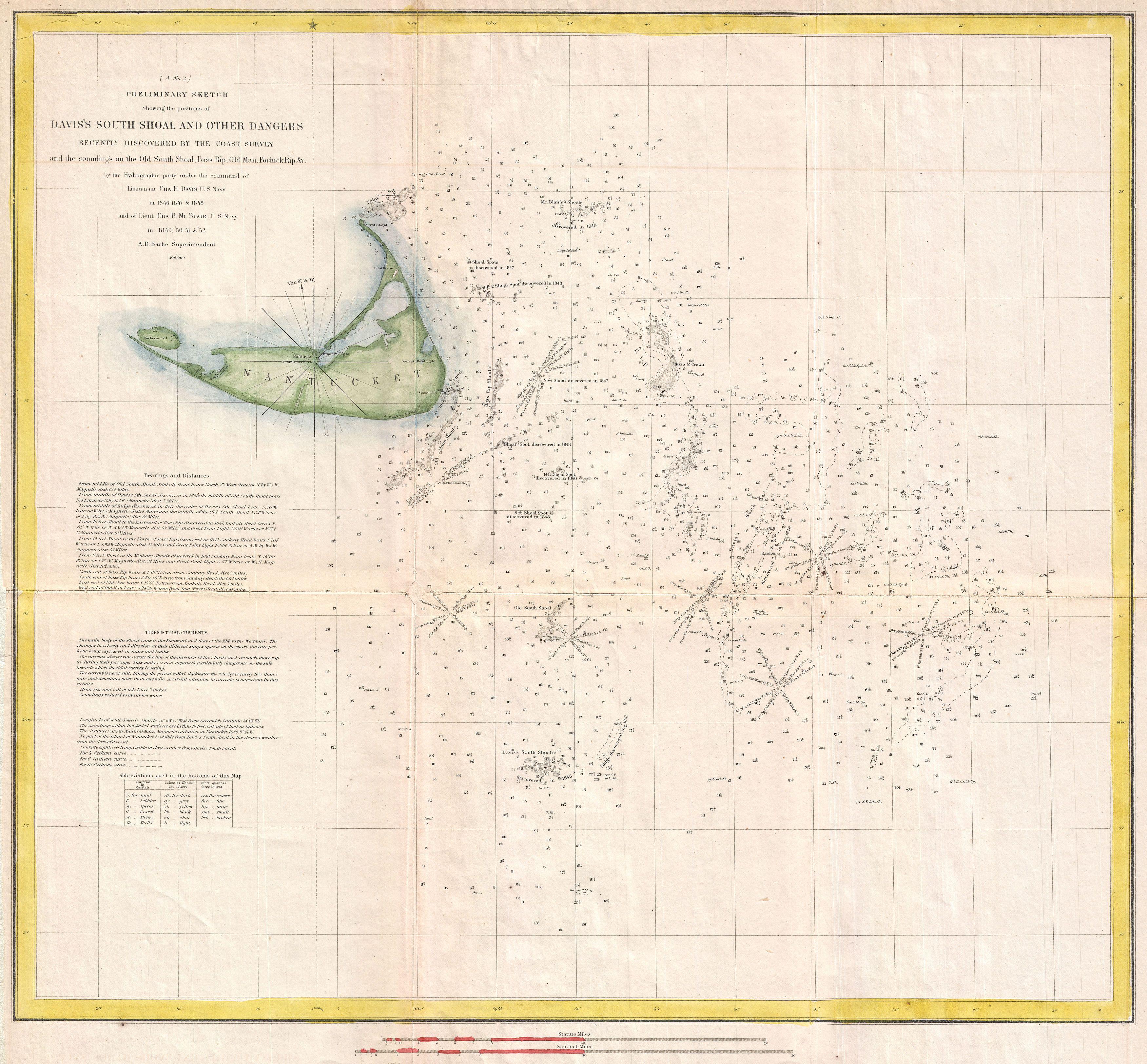
U.S. Coast Survey Nautical Chart or Map of Nantucket Massachusetts Geographicus Nantucketuscs. This beautiful and important sea chart or map depicts the waters immediately surrounding the island of Nantucket Massachusetts including Davis Shoal Old South Shoal and others Uncommon highly significant and often underappreciated this