
Related Images


Download:
| Tiny | 159x128 | View | Download |
| Small | 318x256 | View | Download |
| Medium | 636x512 | View | Download |
| Large | 1273x1024 | View | Download |
| Original | 4000x3216 | View | Download |
This image was acquired from
wikimedia. It was marked as Public Domain or CC0 and is free to use. To verify, go to the source and check the information there.
Looking for more info about this image?
Try a Google Reverse Image Search for it.
Try a Google Reverse Image Search for it.
Keywords from Image Description:
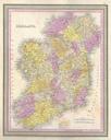
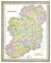
Mitchell Map of Ireland and Scotland Geographicus IrelandScotlandmitchell. beautiful example of Mitchell Jr two map sheet depicting Ireland on the left and Scotland on the right Inset in the upper left quadrant of the Scotland map depicts the Shetland Islands Denotes both political and geographical details One of the most attractive