Related Images


Download:
| Tiny | 112x128 | View | Download |
| Small | 224x256 | View | Download |
| Medium | 448x512 | View | Download |
| Large | 897x1024 | View | Download |
| Original | 4000x4563 | View | Download |
This image was acquired from
wikimedia. It was marked as Public Domain or CC0 and is free to use. To verify, go to the source and check the information there.
Looking for more info about this image?
Try a Google Reverse Image Search for it.
Try a Google Reverse Image Search for it.
Keywords from Image Description:
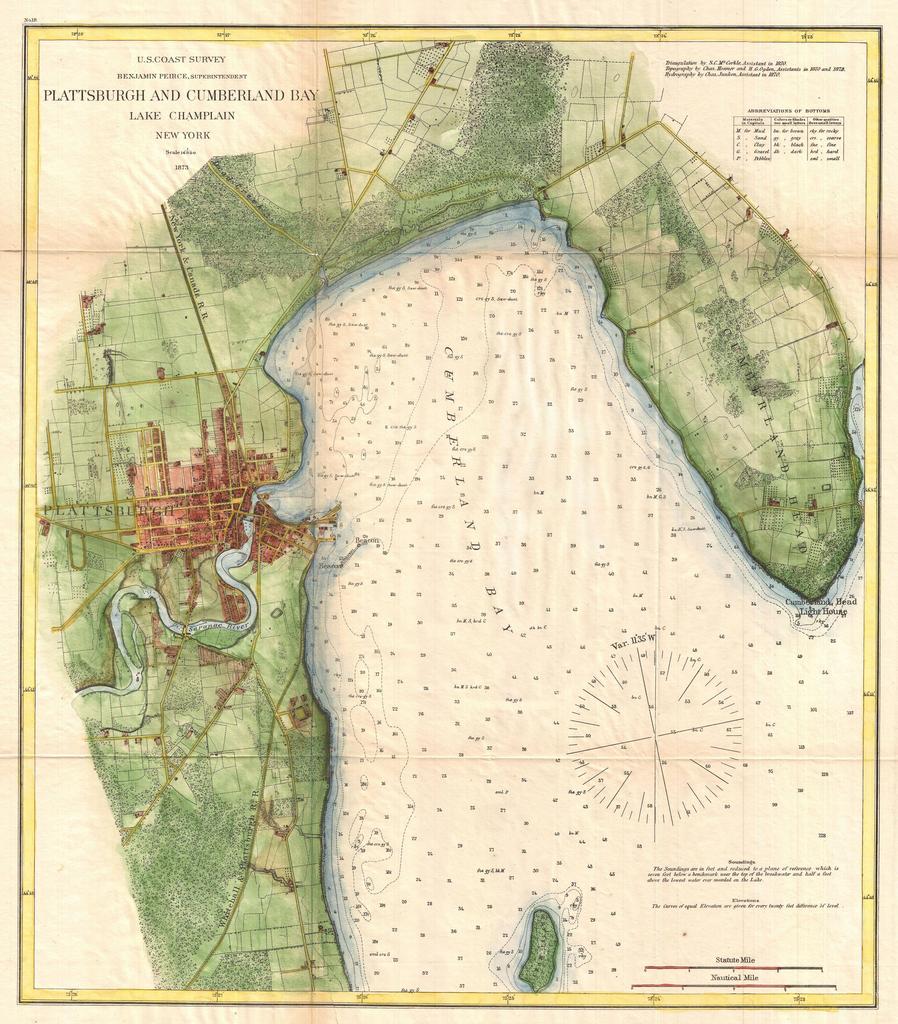
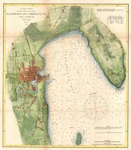
U.S. Coast Survey Map of Plattsburgh and Lake Champlain New York Geographicus PlattsburghCumberlanduscs. very attractive example of the Coast Survey nautical chart or map of Plattsburgh and Cumberland Bay Lake Champlain New York This map covers the urban center of Plattsburgh as well as the surrounding areas as far south as Crab