
Related Images


Download:
| Tiny | 94x128 | View | Download |
| Small | 188x256 | View | Download |
| Medium | 376x512 | View | Download |
| Large | 752x1024 | View | Download |
| Original | 4410x6000 | View | Download |
This image was acquired from
wikimedia. It was marked as Public Domain or CC0 and is free to use. To verify, go to the source and check the information there.
Looking for more info about this image?
Try a Google Reverse Image Search for it.
Try a Google Reverse Image Search for it.
Keywords from Image Description:
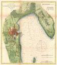
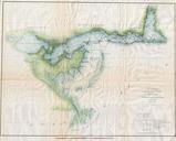
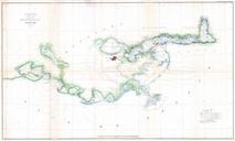
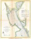
U.S.C.S. Map or Chart of Lake Champlain Burlington VT Geographicus LakeChamplainuscs. rare hand colored coastal chart of the northern part of Lake Champlain from Cumberland Head to Ligonier Point Includes the cities of Burlington Vermont and Plattsburgh New York The map features sailing instructions and hundreds of depth soundings