
Related Images


Download:
| Tiny | 177x128 | View | Download |
| Small | 355x256 | View | Download |
| Medium | 710x512 | View | Download |
| Large | 1421x1024 | View | Download |
| Original | 3673x2645 | View | Download |
This image was acquired from
flickr. It was marked as Public Domain or CC0 and is free to use. To verify, go to the source and check the information there.
Looking for more info about this image?
Try a Google Reverse Image Search for it.
Try a Google Reverse Image Search for it.
Keywords from Image Description:
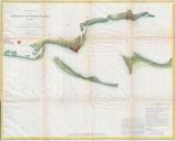
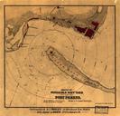
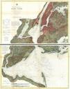
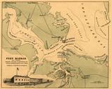
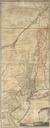
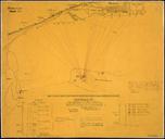
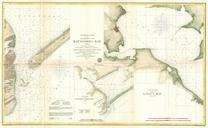
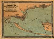
map photo border cartoon text drawing G.P Map of Pensacola Bay showing topography of the coast Fort Pickens U.S. Navy Yard and all other fortifications from the latest government surveys circa . Created by Jacob Weiss. Courtesy of the Library of Congress Geography and Maps Division. G.P Map of Pensacola Bay showing topography