
Related Images


Download:
| Tiny | 93x128 | View | Download |
| Small | 186x256 | View | Download |
| Medium | 372x512 | View | Download |
| Large | 744x1024 | View | Download |
| Original | 4000x5498 | View | Download |
This image was acquired from
wikimedia. It was marked as Public Domain or CC0 and is free to use. To verify, go to the source and check the information there.
Looking for more info about this image?
Try a Google Reverse Image Search for it.
Try a Google Reverse Image Search for it.
Keywords from Image Description:
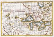
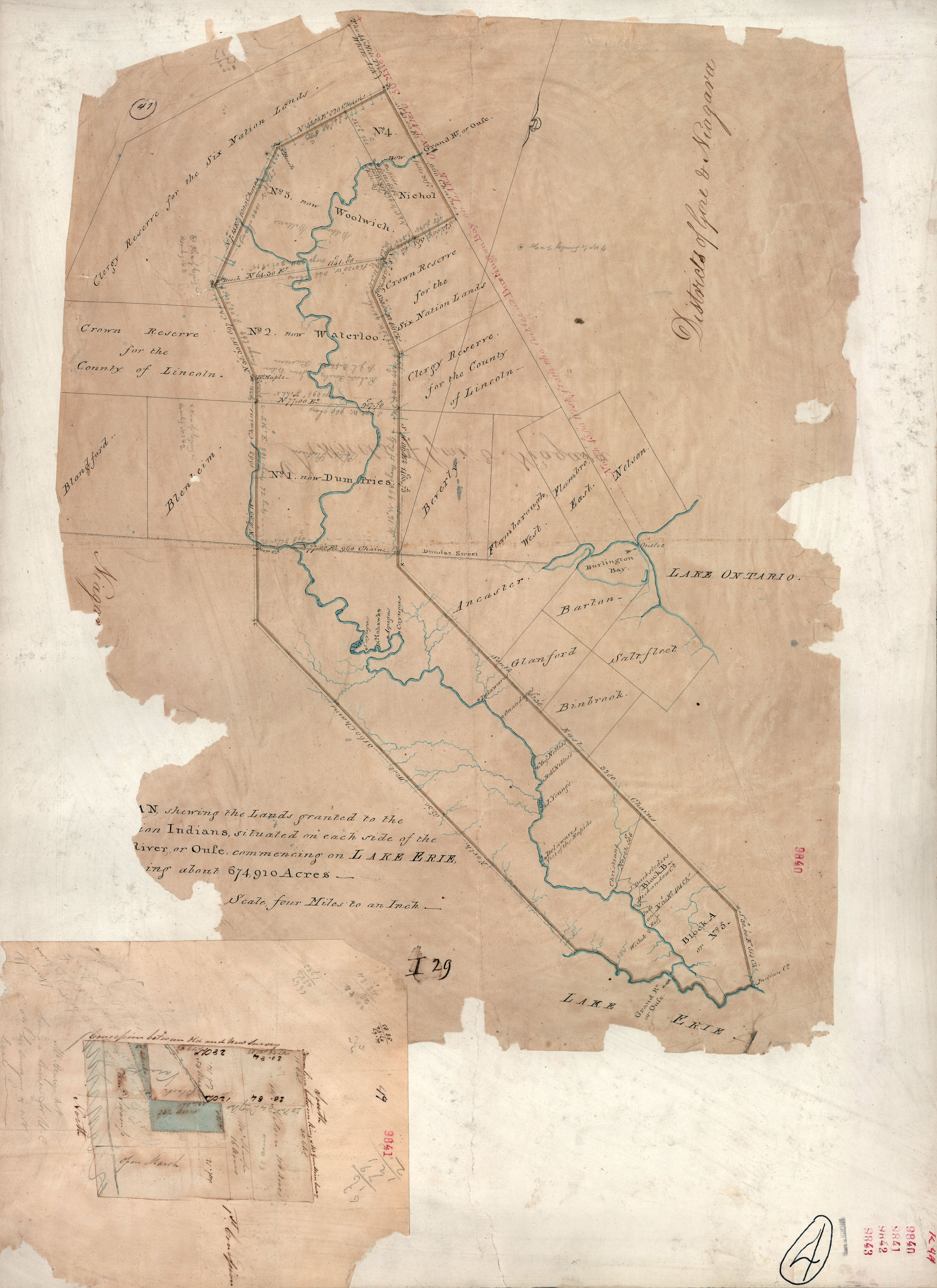
Thomas Ridout map of Grand River Indian Lands . This is survey of the Six Nation Indian lands completed in It is sometimes called the Ridout Survey because Thomas Ridout was the Surveyor General of Upper Canada at the time The image depicts the lands granted to the Six Nation Indians along the Grand River in Upper Canada The Haldimand