
Related Images

Download:
| Tiny | 183x128 | View | Download |
| Small | 366x256 | View | Download |
| Medium | 732x512 | View | Download |
| Large | 1464x1024 | View | Download |
| Original | 5000x3497 | View | Download |
This image was acquired from
wikimedia. It was marked as Public Domain or CC0 and is free to use. To verify, go to the source and check the information there.
Looking for more info about this image?
Try a Google Reverse Image Search for it.
Try a Google Reverse Image Search for it.
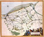
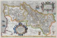
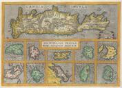
Keywords from Image Description:
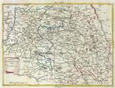
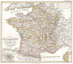
Ortelius Map of Calais and Vermandois France and Vicinity Geographicus Calaisortelius. Two rare regional Abraham Ortelius maps on single folio sheet Left map entitled Caletensium depicts the French and Belgian coastline from Estables to Calais Cartographically based upon four sheet map issued by Nicholas de Nicolay The right map