Related Images

Download:
| Tiny | 189x128 | View | Download |
| Small | 378x256 | View | Download |
| Medium | 756x512 | View | Download |
| Large | 1512x1024 | View | Download |
| Original | 2500x1693 | View | Download |
This image was acquired from
wikimedia. It was marked as Public Domain or CC0 and is free to use. To verify, go to the source and check the information there.
Looking for more info about this image?
Try a Google Reverse Image Search for it.
Try a Google Reverse Image Search for it.
Keywords from Image Description:
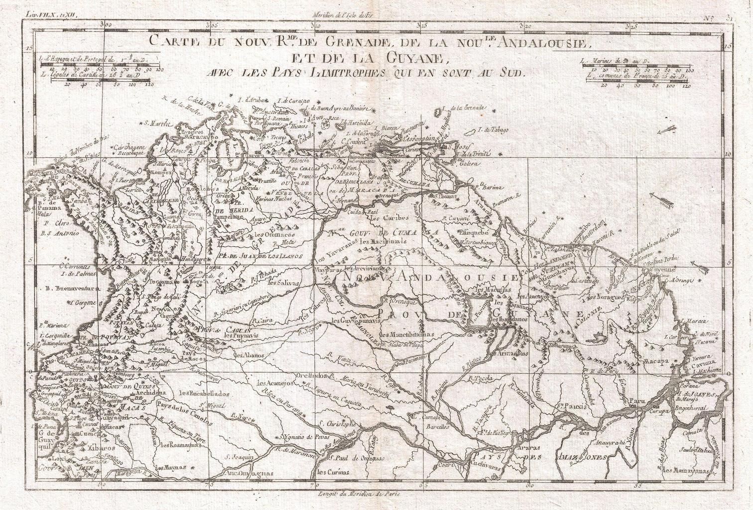
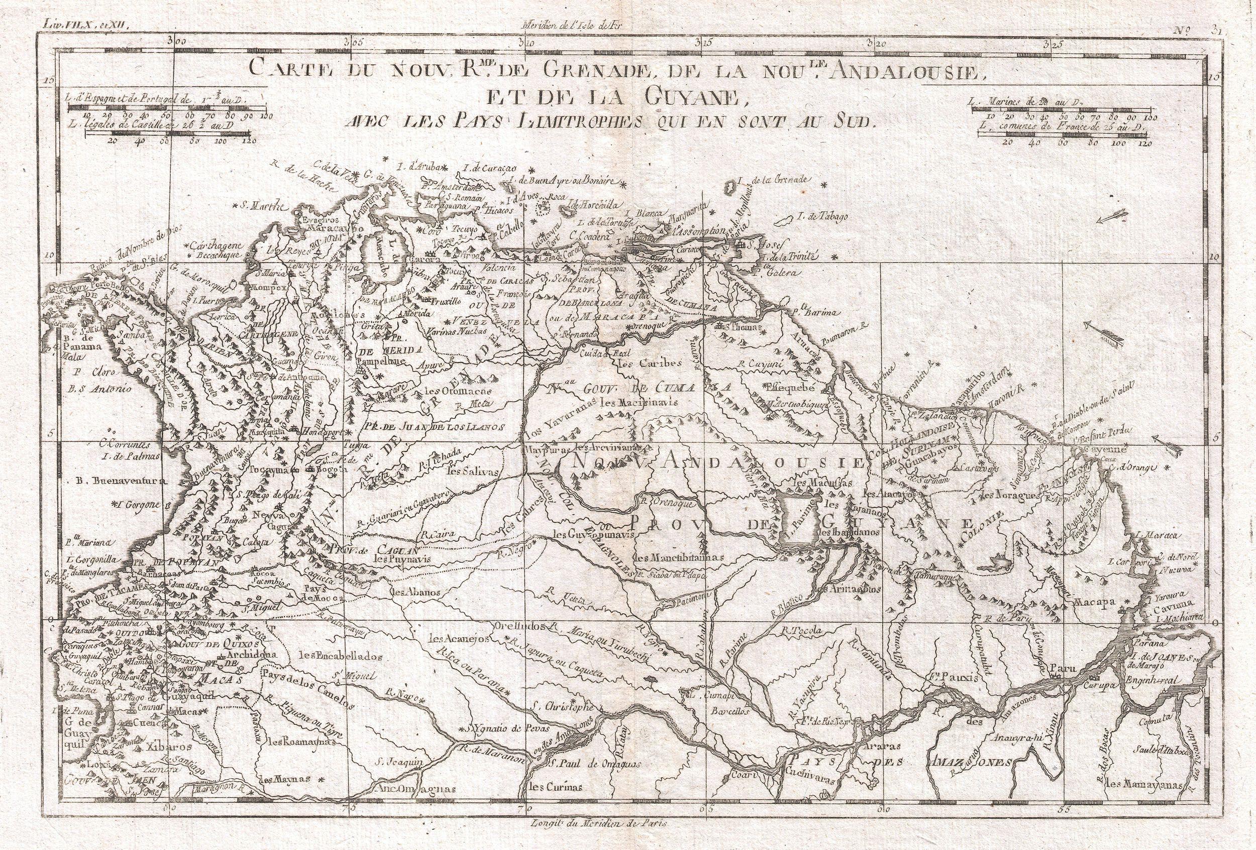
Raynal and Bonne Map of Northern South America Geographicus Grenadebonne. fine example of Rigobert Bonne and Guilleme Raynal map of Northern South America This map includes the area stretching from modern day Ecuador Panama and Columbia to Venezuela Guyane Surinam and the northern portion of Brazil Highly detailed with river ways