
Related Images


Download:
| Tiny | 165x128 | View | Download |
| Small | 330x256 | View | Download |
| Medium | 660x512 | View | Download |
| Large | 1321x1024 | View | Download |
| Original | 3500x2712 | View | Download |
This image was acquired from
wikimedia. It was marked as Public Domain or CC0 and is free to use. To verify, go to the source and check the information there.
Looking for more info about this image?
Try a Google Reverse Image Search for it.
Try a Google Reverse Image Search for it.
Keywords from Image Description:
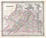
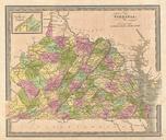
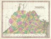
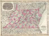
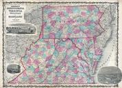
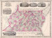
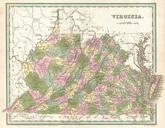
Bradford Map of Virginia Geographicus Virginiabradford. fine example of Bradford's map of Virginia This map covers all of what is today Virginia and West Virginia as well as the entire Chesapeake Bay and adjacent parts of Ohio Pennsylvania North Carolina and Maryland Cartographically sophisticated Bradford's map incorporates political