
Related Images
Download:
| Tiny | 167x128 | View | Download |
| Small | 334x256 | View | Download |
| Medium | 668x512 | View | Download |
| Large | 1336x1024 | View | Download |
| Original | 6000x4598 | View | Download |
This image was acquired from
wikimedia. It was marked as Public Domain or CC0 and is free to use. To verify, go to the source and check the information there.
Looking for more info about this image?
Try a Google Reverse Image Search for it.
Try a Google Reverse Image Search for it.
Keywords from Image Description:
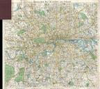
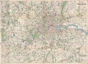
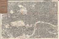
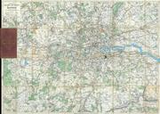
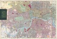
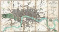
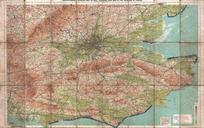
Bacon Traveler's Pocket Map of London England Geographicus Londonbacon. An extremely attractive traveler's pocket map of Victorian London England Covers central London on scale of four inches to the mile from West Kensington in the west across to the West India Docks in the east and from Hampstead down to North Brixton and Camberwell