
Related Images


Download:
| Tiny | 87x128 | View | Download |
| Small | 175x256 | View | Download |
| Medium | 350x512 | View | Download |
| Large | 700x1024 | View | Download |
| Original | 1711x2500 | View | Download |
This image was acquired from
wikimedia. It was marked as Public Domain or CC0 and is free to use. To verify, go to the source and check the information there.
Looking for more info about this image?
Try a Google Reverse Image Search for it.
Try a Google Reverse Image Search for it.
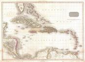
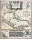
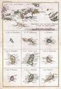
Keywords from Image Description:
Raynal and Bonne Map of the Virgin Islands and Antilles West Indies Geographicus Antillesbonne. fine example of Rigobert Bonne and Guilleme Raynal map of the Antilles or West Indies Essentially maps in one Uppermost map is the largest and details the region from Porto Rico to St Martin encompassing the Virgin Islands Nine smaller