Related Images


Download:
| Tiny | 185x128 | View | Download |
| Small | 371x256 | View | Download |
| Medium | 743x512 | View | Download |
| Large | 1487x1024 | View | Download |
| Original | 4000x2753 | View | Download |
This image was acquired from
wikimedia. It was marked as Public Domain or CC0 and is free to use. To verify, go to the source and check the information there.
Looking for more info about this image?
Try a Google Reverse Image Search for it.
Try a Google Reverse Image Search for it.
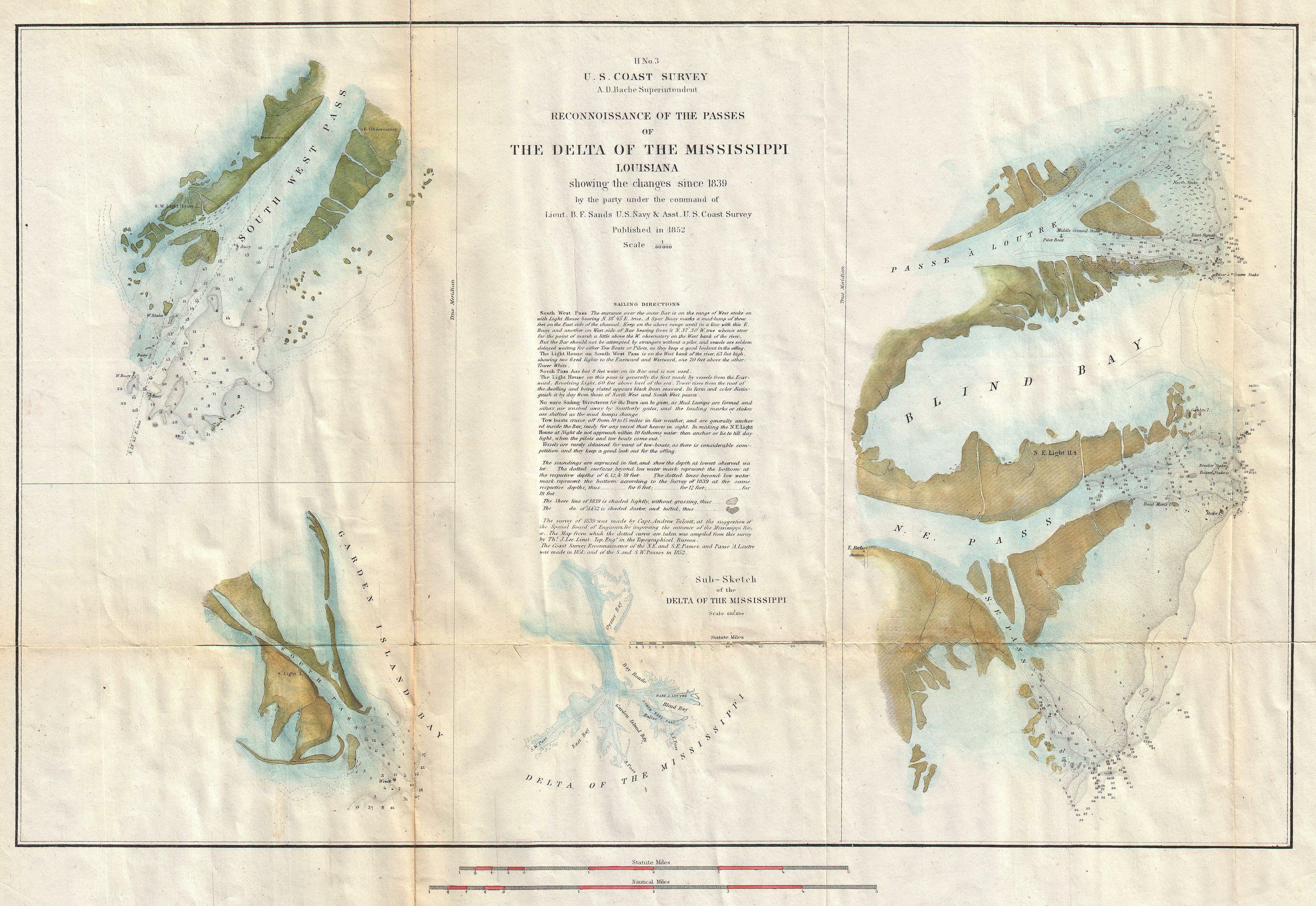
Keywords from Image Description:
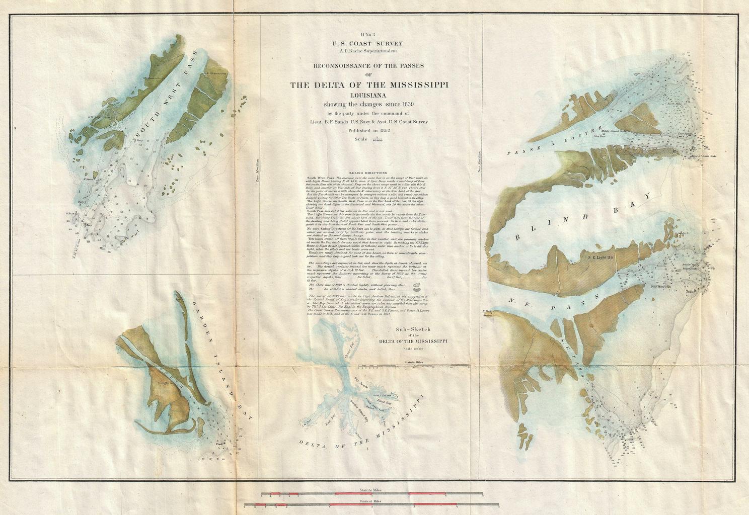
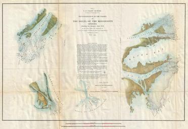
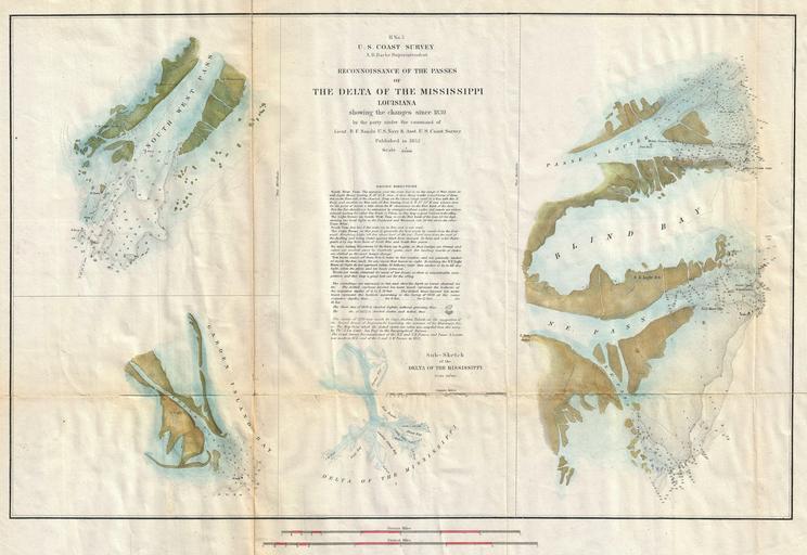
U.S. Coast Survey Map of the Mississippi River Delta Geographicus MississippiDeltauscs. An attractive hand colored Coast Survey triangulation chart or map of the Mississippi Delta This map is in fact composite of four different maps detailing different parts of the Delta The first map in the upper left quadrant details the Southwest