
Related Images


Download:
| Tiny | 188x128 | View | Download |
| Small | 376x256 | View | Download |
| Medium | 752x512 | View | Download |
| Large | 1505x1024 | View | Download |
| Original | 4000x2721 | View | Download |
This image was acquired from
wikimedia. It was marked as Public Domain or CC0 and is free to use. To verify, go to the source and check the information there.
Looking for more info about this image?
Try a Google Reverse Image Search for it.
Try a Google Reverse Image Search for it.
Keywords from Image Description:
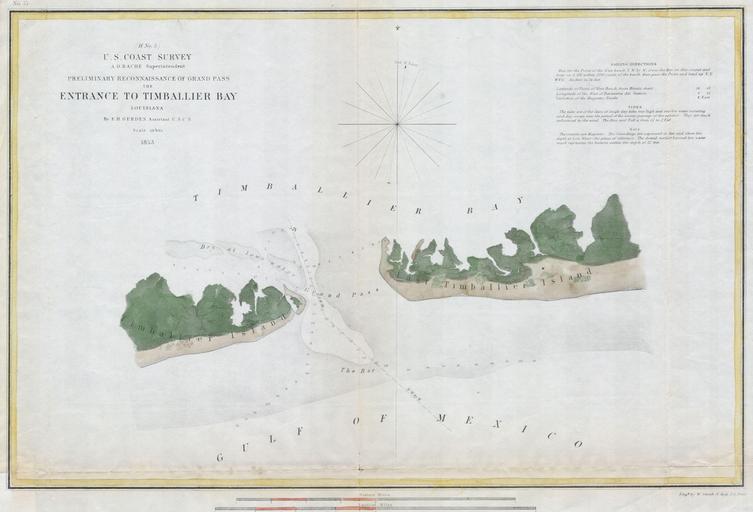
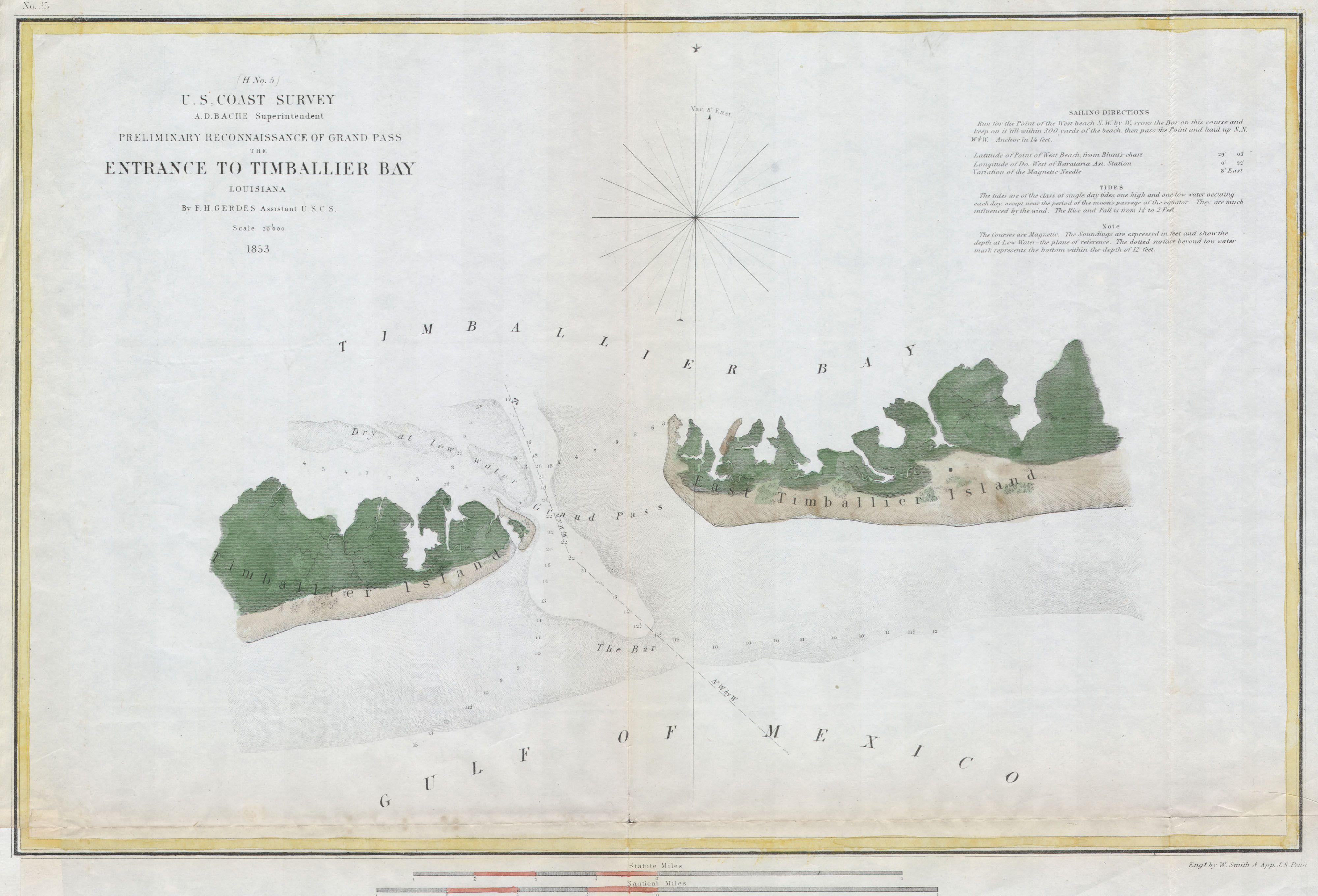
U.S.C.S. Map of Timbalier Bay Louisiana Geographicus TimballierBayuscs. rare hand colored costal chart of the Entrance to Timbalier Bay Louisiana Features East and West Timballier Island depth soundings and sailing notes Published under the supervision of Bache for the Report of the Superintendant of the Coast Survey Size in