Related Images


Download:
| Tiny | 134x128 | View | Download |
| Small | 269x256 | View | Download |
| Medium | 538x512 | View | Download |
| Large | 1076x1024 | View | Download |
| Original | 4000x3805 | View | Download |
This image was acquired from
wikimedia. It was marked as Public Domain or CC0 and is free to use. To verify, go to the source and check the information there.
Looking for more info about this image?
Try a Google Reverse Image Search for it.
Try a Google Reverse Image Search for it.
Keywords from Image Description:
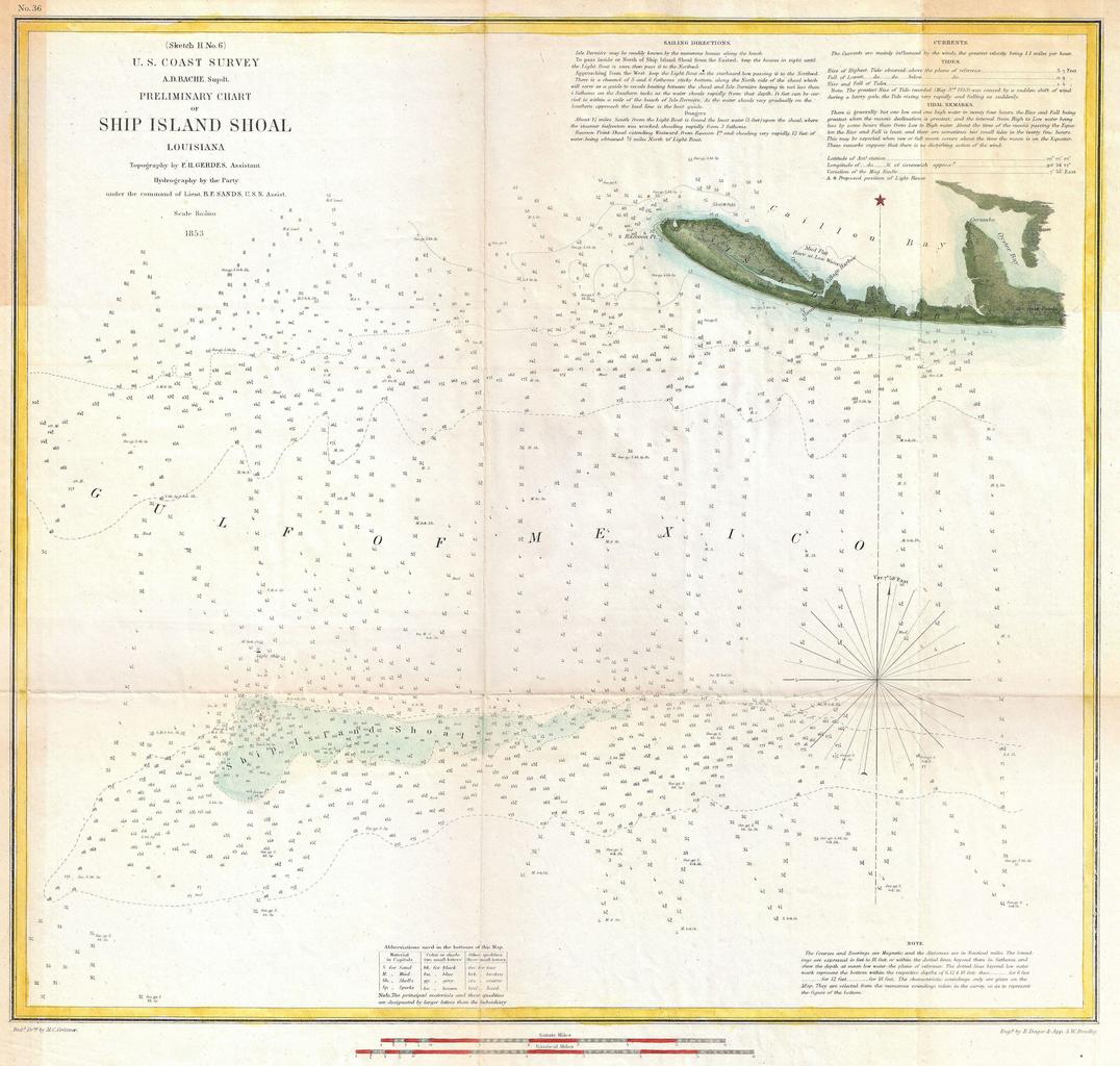
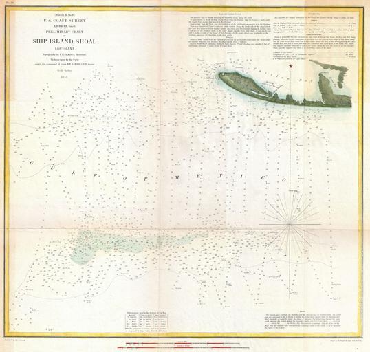
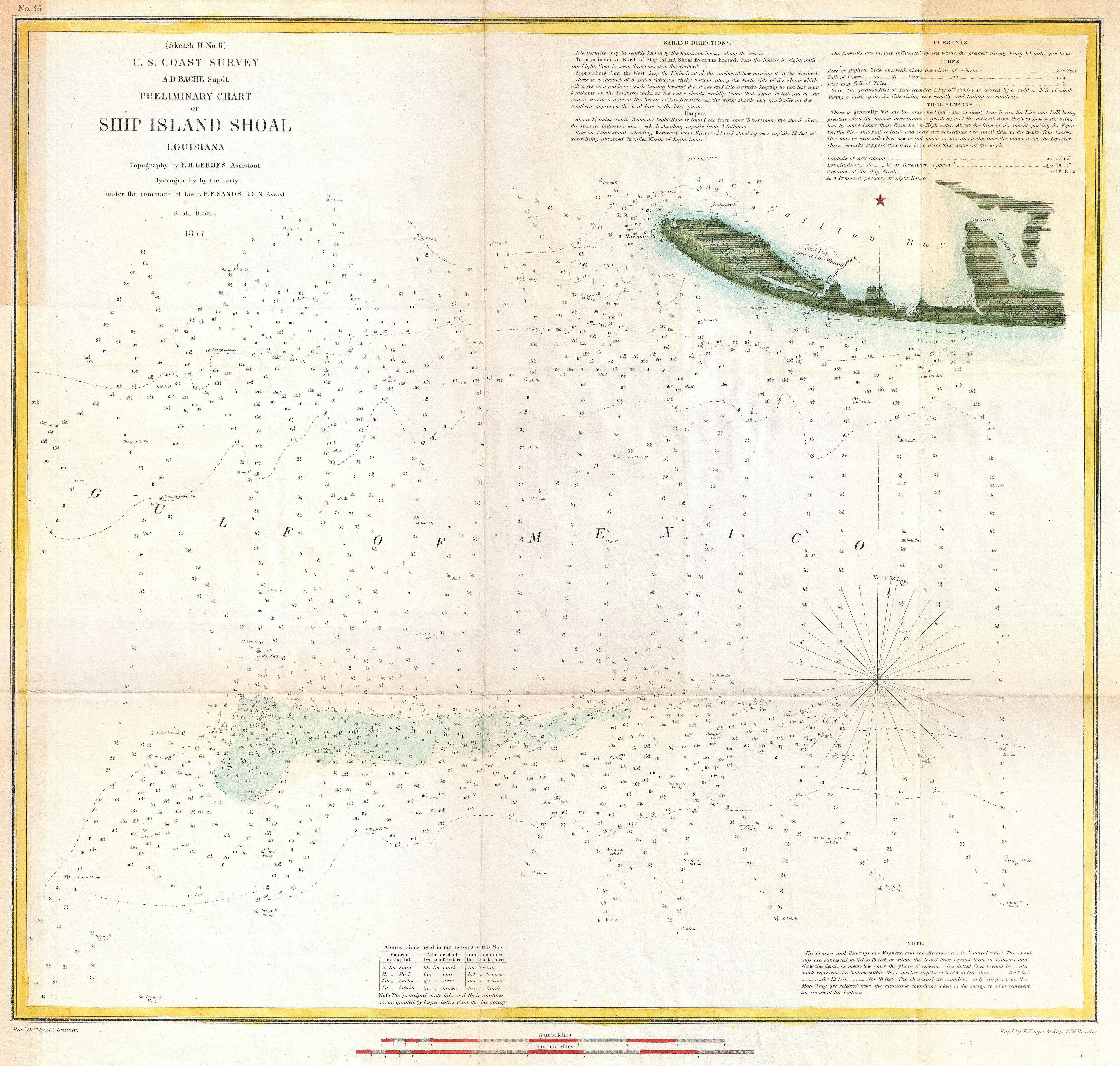
U.S. Coast Survey Map of Ship Island Shoal Louisiana Geographicus ShipIslandShoaluscs. An attractive example of the Coast Survey Map of Louisiana Ship Island Shoal Details part Isle Derniere Ast Island and Caillon Bay Shows Ast Station and the luxurious Ocean Club Hotel both of which were destroyed in the Hurricane of From nautical