
Related Images


Download:
| Tiny | 217x128 | View | Download |
| Small | 435x256 | View | Download |
| Medium | 870x512 | View | Download |
| Large | 1741x1024 | View | Download |
| Original | 3500x2058 | View | Download |
This image was acquired from
wikimedia. It was marked as Public Domain or CC0 and is free to use. To verify, go to the source and check the information there.
Looking for more info about this image?
Try a Google Reverse Image Search for it.
Try a Google Reverse Image Search for it.
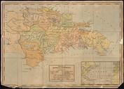
Keywords from Image Description:
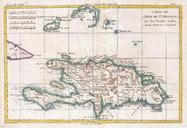
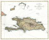
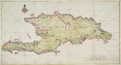
Dufour Map of Hispaniola or Santo Domingo West Indies Haiti Dominican Republic Geographicus StDominguedufour. beautifully engraved map of the West Indies island of Hispaniola or Santo Domingo by the French cartographer August Henri Dufour Covers the entire island in striking topographical detail Identifies towns cities rivers