
Related Images

Download:
| Tiny | 102x128 | View | Download |
| Small | 205x256 | View | Download |
| Medium | 410x512 | View | Download |
| Large | 821x1024 | View | Download |
| Original | 2974x3705 | View | Download |
This image was acquired from
wikimedia. It was marked as Public Domain or CC0 and is free to use. To verify, go to the source and check the information there.
Looking for more info about this image?
Try a Google Reverse Image Search for it.
Try a Google Reverse Image Search for it.
Keywords from Image Description:
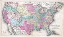
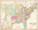
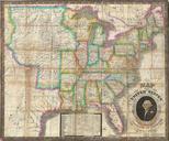
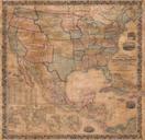
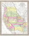
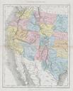
Dower Map of the Western United States Geographicus WesternUSAdower. This hand colored map depicts the western half of the United States including Texas Arizona California Utah and Nevada The map was made in by the English mapmaker Mackenzie It shows Arizona extending into what is today Southern Nevada Utah has two important