
Related Images


Download:
| Tiny | 144x128 | View | Download |
| Small | 288x256 | View | Download |
| Medium | 576x512 | View | Download |
| Large | 1152x1024 | View | Download |
| Original | 5000x4443 | View | Download |
This image was acquired from
wikimedia. It was marked as Public Domain or CC0 and is free to use. To verify, go to the source and check the information there.
Looking for more info about this image?
Try a Google Reverse Image Search for it.
Try a Google Reverse Image Search for it.
Keywords from Image Description:
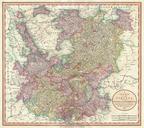
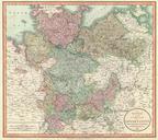
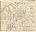
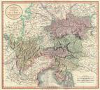
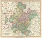
Cary Map of Franconia Germany Nuremburg Geographicus Franconiacary. An extremely attractive example of John Cary map of Franconia Germany Covers from Upper Saxony south to Swabia west to the Lower Rhine and west to the Bavaria Includes the important mediaeval and renaissance center of Nuremburg Today Franconia is historic district