
Related Images


Download:
| Tiny | 161x128 | View | Download |
| Small | 322x256 | View | Download |
| Medium | 645x512 | View | Download |
| Large | 1290x1024 | View | Download |
| Original | 4000x3174 | View | Download |
This image was acquired from
wikimedia. It was marked as Public Domain or CC0 and is free to use. To verify, go to the source and check the information there.
Looking for more info about this image?
Try a Google Reverse Image Search for it.
Try a Google Reverse Image Search for it.
Keywords from Image Description:
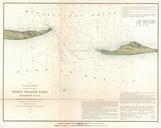
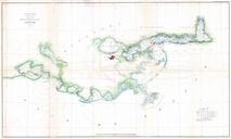
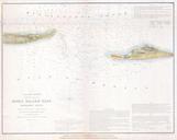
U.S.C.S. Map of Horn Island Pass Mississippi Louisiana Geographicus HornIslandPassuscs. rare hand colored costal chart of the Horn Island Pass Horn Island pass is the entrance to the Mississippi Sound and thence the Pascagoula River from the Gulf of Mexico Depicts Horn Island and the western part of Petit Bois Island Chart