
Related Images


Download:
| Tiny | 92x128 | View | Download |
| Small | 185x256 | View | Download |
| Medium | 371x512 | View | Download |
| Large | 743x1024 | View | Download |
| Original | 2905x4000 | View | Download |
This image was acquired from
wikimedia. It was marked as Public Domain or CC0 and is free to use. To verify, go to the source and check the information there.
Looking for more info about this image?
Try a Google Reverse Image Search for it.
Try a Google Reverse Image Search for it.
Keywords from Image Description:
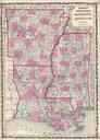
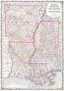
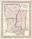
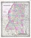
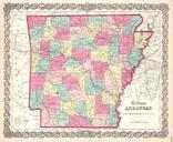
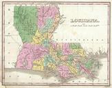
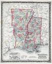
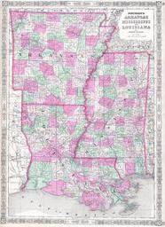
Johnson Map of Louisiana Mississippi and Arkansas Geographicus MSLAAKj. This is beautifully hand colored lithograph map of Arkansas Louisiana and Mississippi Shows the states in beautiful detail as they appeared at the close of the American Civil War Size in object history credit line accession number MSLAAKj Geographicussource