
Related Images


Download:
| Tiny | 209x128 | View | Download |
| Small | 419x256 | View | Download |
| Medium | 839x512 | View | Download |
| Large | 1678x1024 | View | Download |
| Original | 5000x3051 | View | Download |
This image was acquired from
wikimedia. It was marked as Public Domain or CC0 and is free to use. To verify, go to the source and check the information there.
Looking for more info about this image?
Try a Google Reverse Image Search for it.
Try a Google Reverse Image Search for it.
Keywords from Image Description:
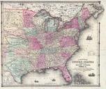
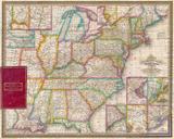
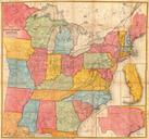
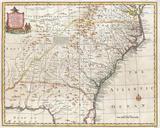
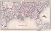
Walling Map of Texas Florida and the Southern States Geographicus SouthernStateswalling. This is an attractive map of the southeastern United States by Henry Walling Dates to shortly after the conclusion of the Civil War When this map was made the southern states were in the midst of economic depression and the reconstruction